

Apologies: We have sold out of Map Series A. We expect to have updated maps back in stock by mid-late April. So sorry for this inconvenience. Do check out the digital version via the Avenza app.
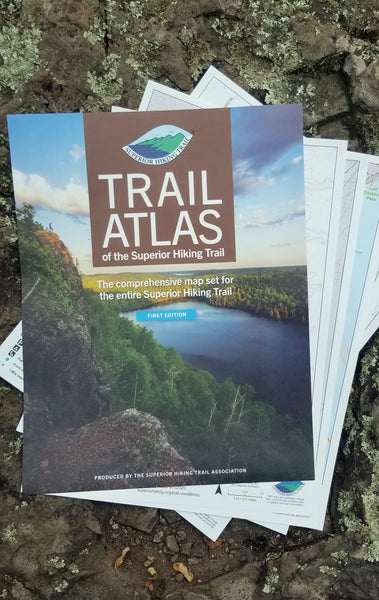
The Map Series is the Trail Atlas of The Superior Hiking Trail broken up into 6 sections.
The Trail Atlas is already divided this way with section labels at the bottom of each page, but in the Map Series we separated them into separate packaging for your convenience.
If you are taking your first hike on the SHT and not ready to invest in the entire Trail Atlas this is a great option for you. This option was developed for people who concentrate their hikes to specific sections of the Trail. The maps are exactly the same loose leaf pages as what are in the Trail Atlas.
SHT maps and information change often. Check the trail conditions page for updates, trail rules, and data sources at superiorhiking.org/trail-conditions. Cover photo by John Keefover of Keefography.